Visual Materials
St. Vincent. Barbadoes. (Two maps on one sheet)

You might also be interested in
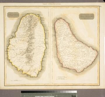
St. Vincent. Barbadoes
Visual Materials
See also 105:117 for another possibly later copy. "Engraved by Kirkwood & Son. Edinburgh." "No. 67 (upper right)" Prime meridian: London, Ferro. Relief: hachures. Graphic Scale: Miles, leagues. Projection: Plane. Printing Process: Engraving. Verso Text: MS note: 791.
105:791 M
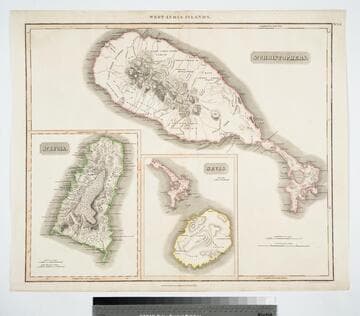
West India Islands - St. Christophers. ; West India Islands - Nevis. ; West India Islands - St. Lucia
Visual Materials
Three maps on one sheet. Kashnor dates as [1816]. Prime meridian: London, Ferro. Relief: hachures. Graphic Scale: Miles, leagues. Projection: Plane. Printing Process: Copper engraving. Verso Text: MS notes: 777 West Indies Thomson.
105:777
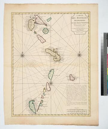
Carte des Antilles Francoises et des Isles Voisines Dresée sur les memoires manuscrits De Mr. Petit Ingenieur du Roy, et sur quelques observations. Par Guilleaume de L'isle et de l'Academie Rle. des Sciences et Premier Geographe du Roy
Visual Materials
Short history of these islands lower right. Kashnor dates as ca. 1720. See 105:945M and 093:721M for earlier versions. Prime meridian: Ferro. Relief: no. Graphic Scale: Leagues. Projection: Cylindrical. Printing Process: Copper engraving. Verso Text: MS notyes: 105/471 146 Les Isles Antilles 76.
105:471 M
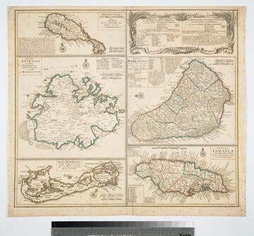
Dominia Anglorum in preacipius Insulis Americae, ut sunt Insula St. Christophi, Antegoa, Jamaica, Barbadoe, necnon Insulae Bermudes vel Sommers dictae
Visual Materials
Kashnor notes, "a scarce map. five maps on one sheet." Map title is both Latin and German, place names on maps in English. Kashnor dates as c. 1750, publication in Nuremberg. See 105:182M for another state of this map, possibly earlier. RLIN record dates as 1759. Five submaps: St. Kitts, Antigua, Bermuda, Barbados, Jamaica. Relief: pictorial. Graphic Scale: Milliaria. Projection: Plane. Watermark: Shield or device. Printing Process: Copper engraving. Verso Text: MS note: 950.
105:950 M
Image not available
Carte du Canada ou de la Nouvelle France et des Decouvertes qui y ont été faites Dresée sur les Observations les plus Nouvelles, & sur divers Mémoires tant Manuscrits qu' imprimez
Visual Materials
Kashnor notes, "This is the Châtelain map, taken from DeLisle. It locates only the French forts around Hudson's Bay, and shows a correct idea of the locations of the Indian tribes west of the Great Lakes; also shows La Houton's assumed location of the great River of the West, and the western sea beyond the range of mountains." Kashnor dates as ca. 1720. See 105:431 for another version, 105:433 for an earlier version. Historical remarks replace of cartouche on 105:431 version.. Prime meridian: Ferro?. Relief: pictorial. Graphic Scale: Miles, leagues. Projection: Pseudocylindrical. Printing Process: Copper engraving. Verso Text: MS note: 432.
105:432 M
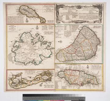
Dominia anglorum in preacipuis insulis Americae : ut sunt insula St. Christophori Antego Jamaica Barbados nec non insulae Bermudos vel Sommer dictae singulari mappa omnia exhibita et edita / ab Homannianus Heredibus. Cum Privil. Sac. Caes. Majestatis
Visual Materials
Kashnor notes, "a scarce map. five maps on one sheet." Map title is both Latin and German, place names on maps in English. Kashnor dates as c. 1750, publication in Nuremberg. See 105:182M for another state of this map, possibly earlier. RLIN record dates as 1759. Other copies in OCLC dated as 1740. Also see 105:950M for another copy. Five submaps: St. Kitts, Antigua, Bermuda, Barbados, Jamaica. Relief: pictorial. Projection: Plane. Printing Process: Copper engraving.
093:132 M